Saturday 28 April 2012

Nias, Telo, Batu, Tanabahla Islands and Siberut island ( 15th April to 24th April 2012)

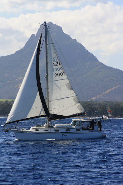
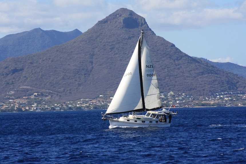
On the 15th of April we left Afulu on Nias Is  for Palau Asu with SV Leto. We anchored off a very picturesque beach next to this local boat with a very happy young lad singing away and pumping the bilges..


We kayaked ashore and took the children lollies much to their delight.


The next day we motorsailed to the bottom of Nias Island to Teluk Lagundri. This is an extremely popular surfing spot.


SV Serannity arrived (Lou and Ann) whom we'd met in Langkawi and we were all invited to a meal aboard. It was great catching up on their adventures.


The next morning we beat the others out of bed and headed for Palau Telo. They soon caught up and we had a day of shifting wind and rain followed by good winds....About time.. Eric caught a bonito which he filleted and we cooked some fillets straight away. It was delicious...
The next highlight was crossing the equator and to re enter the southern hemisphere. It was too rough to swim across the line so we celebrated with a rum instead.


We anchored off the island of Telo to the sound of pigs squealing. It appeared to be a predominantly christian island with more churches visible than mosques


Celebrations were held aboard Leto that night.

 After re provisioning with fruit and veges, we organised diesel and then enjoyed coffee at a seaside cafe, Indonesian style..

A ship had been in the day before so local boats were coming in to pick up supplies to take to the outer islands

That afternoon we motored between a narrow gut of reefs and land to the Batu islands. They are low lying and coral fringed with palm trees and few inhabitants. Cathy stood on the spreaders up the mast to spot reefs and to take photos along the way

Satellite dishes were quite common

 We went ashore the next day to stretch our legs and burn our rubbish and  discovered a surfers lodge and restaurant being built.
Another day of motoring took us to the island of Tanahbala. We had to keep a good lookout as there are reefs just above the surface and low lying islets all very wrongly charted. The entrance into the bay where we anchored was interesting as the reef on both sides was throwing up some spectacular crashing waves.


We have found the Indonesian people have a great sense of humour and very friendly


We anchored in calm water. The swell was dampened by the reefs.
The next day we were visited by dugout canoes full of school children and they were delighted to be given books, pens and pencils


Boys and birds competing for fish


After an overnight sail we arrived at Limo on the island of Siberut where there was a fishing village and busy trading post


This massive jellyfish  passed under the kayak. It's tentacles were huge


Squid boat


After an overnight voyage we arrived in the port of Teluk Bayur in Padang.
That will be another story

Cruisers Notes

ASU: 00'54.3891N 97'16.8040E We anchored in 20m. We gave reasonable scope from the shore as we were exposed to the East. The bottom is sand. This is a pretty place. The resorts were empty. We gave lollies to the children ashore and felt that the locals were friendly. We found a small patch of fresh good coral with lots of fish life just 20m to the north of the jetty.

LAGUDRI: 00'33.76N 97'44.31E This anchoring area seemed to be the most free of swell. At the time we were there it was almost flat. There were quite a few surfers on the break on the far side of the bay. We didn’t go ashore.
TELO: 00' 02.493S 98'16.96E We anchored several hundred meters to the north of the wharf. The town looked very interesting. As always one is never sure whether one is going to be challenged by a harbour master. We went ashore, landing on a small sandy patch right next to the wharf. There were official looking buildings with uniformed people lurking around them but I don’t think that they were keen to do any paper work. Just outside the wharf area we found good vegetables and solar at 6000 /L . But the young side car lad wanted 120000 to deliver it the 50m to the dinghy!

PALAU BATU: 08'1326S 98'20.67E We anchored in sand, 16m. Be aware that the fringing reef to the north projects out a moderate distance in some spots. The area and landing in front of the resort is sand and weed but with some bombies . We went ashore and looked around. Easy and interesting. A young builder from the work crew making a good job of the new building that was under construction was detailed to look after us. Unfortunately he had no English. We burnt our rubbish ashore.

TANAHBALA: Finger Bay: 00' 20.174S 98'2931E Approach the anchorage straight down the middle of the bay there will be large breaking swells on each side that may have surfers on them. At the time and weather state when we were there the swells at the top of the bay were almost completely gone. The top of the bay shallows to a large area of around 3m. The bottom is sand and a beard like weed. The bay is picturesque and we had a nice visit from school children. They appreciated lollies, pens and books. Unfortunately on our second day we were approached by two aggressive men waving a piece of paper hand written in Indonesian with an official stamp on it. They wanted mooring fees. We pretended not to understand but this didn’t work so we got angry and sent them away. We upped anchor and left.
LIMU: 01'04.8237S 98'57.3282E This little hideaway may show on electronic charts as the Tabekat river. We thought of the place as Tabby cat! Please note that we did not go ashore here. We sat for two days observing, keeping a low profile and relaxing. The anchorage is very sheltered although there is modest fetch to the north. The holding is exceptional in heavy sand mud mix. ( 10 to 14m)The access is good but there is a ridge extending across the entrance that gets down to 6 to 7m. This seems to be a busy little port with a small commercial wharf and a small supporting trading post (no mosque). There is a lot of river boats bringing goods to trade. The river may be fun to explore by dinghy. There is a large drying sand bar off the river mouth marked on the charts. We suspect you would find most basics here. We dare say there is a harbour master here but one could go straight to the trading post at high tide and avoid the wharf.


Friday 13 April 2012

Simeulue Islands ( 5th April to 15th April 2012)

On the 5th of April we left the mainland of Sumatra and sailed/motored overnight to the Simuelue islands. 


They are rocky volcanic islands blanketed in rainforest and fringed with coconut palms and clove plantations. Tourists are not very common here apart from keen surfers
We had a full moon and light conditions with the occasional rain cell. It was beautiful sitting on deck bathed in moon beams. We were visited by dolphins, making their presence known by the sound of their spouting, followed by acrobatics in the moonlight. It was the right time to play my ukelele.


 Not wanting to make landfall at night and having a time schedule we continued down the island to the southern end and anchored in a sheltered channel between 2 islands, near the village of Labuhanbajau.


We shared the bay with Jim and Helen on SV Gaia (Canadian). It is a very calm anchorage surrounded by mangrove covered coral outcrops and the only sounds were birds and the dipping of paddles by fishermen.


On the 8th we joined SV Gaia and headed to Palau Lasia, 18nm south. A pretty little island not offering much shelter but since it was calm we decided to stay overnight. We enjoyed coconut crab and rum as the afternoon became evening.


In the night we were woken with a jolt as the boat pitched and rolled with 25-30knts of wind and 1-2m waves. It carried on for 2 hrs, the anchor held well and Cathy was able to enter into Erica's book of records "Vomited on anchor"
After a morning of kayaking, swimming and walking on the island we upanchored and headed for the  island of Nias, 57nm SE. With 2 trolling lines out we didn't catch any of these fish the dolphins were rounding up. Nearing the island at dark and in torrential rain and squalls we "hove to " until daylight to enter Lahewa lagoon.


It was a very sheltered anchorage
We tied the dinghy up at the wharf and walked into the village to see the harbour master/coastguard.


We enquired about getting fuel and one of the men took Eric on his motorbike to the garage to buy a 200L drum of diesel, then he organised a motorbike and sidecar to deliver it to the wharf.
Cathy went to the market behind the coastguard office and purchased fruit and vegetables
All along the road were cloves drying


We brought "Erica" alongside this very good wharf and siphoned fuel into our tanks. .

It was after morning school and the kids lined up to watch us and to practice their english. Very few tourists come here and everywhere we went the people were inquisitive as to where we were from and what we were doing there


We met Fidel who is a lobster diver and he took us to his holding pens which was really interesting. The person he works for exports all over Asia

We were amazed by the varieties and size of lobster that they harvest here. We bought Slipper lobsters and dined on these that evening. they were delicious!


The next day we headed to Palau Hula Wunga which before the 2005 earthquake was a fully enclosed anchorage. Now it can only be entered with a very shallow draft vessel. The sea bed has been raised we've been told by 4m. On the other hand at Afulu across on Nias island an island has become connected to the land and is now a very protected anchorage

We left Palau Hula Wunga and were oblivious to an 8.7 earthquake that occured as we were sailing. When we entered Afulu between 2 reefs Cathy was on the bow ready to take photos as very large waves were breaking on the reef. She was confused as the waves suddenly ceased.
as we entered the lagoon we noticed another yacht at anchor and she was rocking up and down.


we anchored and our new neighbour roared across in his dinghy to inform us that an earthquake had happened and a small surge had come into the bay. As we were talking to him we felt an aftershock and the whole boat shuddered.
We felt quite anxious as night fell but were reassured by information on the internet that there was no tsunami.


The next day we explored the bay. The following photos are showing the effects of the 2005 quake that shook this area and caused the raising of the seabed. The coral is now land.


This was once a deep waterway and island to the left of the picture


Kevin from SV Helena is a keen surfer and each day he took his boat out beyond the reef to surf the waves. The west Sumatran islands are a popular world renowned surfing spot with some of the best surfing in the world. Kevin has been coming to the area for 5 consecutive years.


We went into the village to buy some eggs and the people were very friendly and helpful


We notice all over Indonesia there are thousands of new mosques being built even in the most remote and poor areas there will be several in town. We do wonder where the funds come from for these?


CRUISERS NOTES
Simeulue Island...Labuhanbajau..
Note that we approached the land in the north and followed it around in about 30m. This was to ensure that we passed the rock awash in the middle of the entrance with a safety margin. We entered at high spring tides and did not see this rock. On exiting to the south it did at one stage become quite shallow at around 3.5m and we noticed a yellow bombie which had less water covering it.
We anchored in around 12-15m. Gaia anchored in shallower water and brought up a lump of coral on their anchor. We were anchored in mud

Nias Island...Lahewa lagoon/harbour
The information in "101 anchorages" we found accurate. The waypoints were helpul
We chose to anchor in view of the wharf in good holding mud from 7-20m
We landed next to the Tsunami warning building on the wharf and tied off to the railing. We found this a reasonably good access from our dinghy, although a bit of a climb at low tide
The harbour master's office is about 30m from the wharf gates on the left. They were very helpful but limited English
Bank but no ATM
Fidel Chen (lobster fisherman) speaks excellent english Ph 081370277919
Exaa Nazara (student) 0813916160880 also speaks excellent english offered his services

Afulu
The information in "101 anchorages" we found accurate. The waypoints were helpul
Very sheltered bay. Be aware that there are some rock outcrops in places you may not expect them so stay in the recommended anchorage.
Beach access is great on sand. Keep an eye out for rock outcrops just off the beach.
Landing and access to the town is in the direction of the communication of the tower and just to the left of the local boats on the beach. The tower is where the town is. It is a short walk
Most supplies are available here, including beer and if there is something you cannot get contact
Makmur or his brother Darus, both speak good english and are very nice men willing to help
Makmur ph 081370951444
Darus Ph 081263578874
Small town. No ATM


Thursday 5 April 2012

Banda Aceh to Palau Raya, Sumatra ( 2nd April to 5th April 2012)

We left Weh island on the 2nd of April for Lampageue, on the western headland of Banda Aceh. It was a good anchorage in sand. The electronic charting showed several islands, but they are not there. We assume they have been washed away with the Tsunami and earthquake of 2004.
This man was setting a net in the shallows


We walked through the village and could see the effects of the Tsunami. Eroded roads, sunken boats, tree trunks off shore in the water, streams blocked and no longer flowing and new housing.
We had so many questions but they had to go unanswered. We didn't want to ask the local people as our Bahasa is limited and so was their English. There must have been so much grief here that it was almost palpable


These woman were happy to sell us some supplies from their roadside stall and we laughed together as we attempted to communicate


Above the village is are steep steps to the top of a hill built after the Tsunami as an escape route.


Looking out across the landscape you can easily imagine why there was so much devastation


People were very friendly and inquisitive as we walked along the village road.
The next day we continued south passing strings of coastal villages and endless beaches with towering forested peaks behind.
We anchored behind a cape in Seudu Bay where these interesting fishing boats were moored. At night they fished for anchovies


We explored the village here and again saw the effects of the Tsunami disaster


We needed diesel and this took most of the afternoon. We dinghied ashore after locating an entrance in the reef, carried a jerry can and trundler along the road and had to go to 2 stalls to get 24litres. This was poured from a drum and measured by a jug after being dipped into a pail. The fuel looked dark but clean and to make sure we strained it through a filter


We were not the only ones walking along the road!


Anchovies drying in the sun


This motorbike was well laden. It was parked alongside a mosque and to the left of the photo one can see a cardboard replica of a TV screen which we assume the local cleric stood inside as a tool to get the attention of his parishioners during his sermons


Water Buffalo were basking in the shallow and warm water as we passed in the dinghy


Men getting ready for a nights fishing


As a reward for our diesel carrying efforts we sat in one of these pagola's drinking cool fruit juice watching the activities in the village below, followed by a meal as the sun went down.


On the 4th of April we headed out at dawn with yachts Leto and Fast Forward. Our sailing joys were short lived as the wind came around head on. We decided to pull in behind an island at Cape Tangkuru. The charting shows one island but we discovered there were 2.. It appeared that part of the mainland was washed away, separating the land now by sea.


Eric in his element trolling the reef. We didn't have fish that night!

The beach looked like silica sand from a distance but it was bleached broken coral


As we circumnavigated the island by dinghy we came across this cave.These fishermen have set up a neat home amongst the cliffs


Away at dawn again brought us through a gap between the mainland and Pulau Raya where the fishing boat style changes again.


With great internet reception from the numerous towers along this coastline I am able to write my blog while we are underway


We decided to continue south as the others stayed on in Pulau Raya


Cruising Notes
LAMPAGEUE
A handy spot just beside the Southern most pass above Aceh region. 05' 33.91 N 95' 14.37 E .Good holding on a sand bottom. We experienced a calm night. We went ashore and we could easily see evidence of the Tsunami.
SEUDU
We anchored at 05' 21.36 N 95' 14.39 E. Barbara Ann's cruising guide is helpful. Google picture gives a better over view of the layout. Easy approach. Good holding. Mind the fringing reef. Landing is on a steeply sloping broken coral beach near the partly completed structure to south of the restaurant on the bluff. Or up stream where the larger fishing boats berth on sand. We got good diesel here. We had a nicely presented meal of nasi goreng and BBQ fish at the restaurant.
CAPE TANGKURU
This is no longer a cape. Systemic events have made it an island but the locals indicated that you should not pass to the south of the new island. We anchored at 05'07.71N 95'17.68E in 12m of water behind the island as charted. There is still a large area of good anchorable depth as indicated by the charts but it may suffer from swell now the cape has gone . We spent a good night here The island is very picturesque with large caves on the seaward side.
PALAU RAYA
We did not stop here but we passed between the island and mainland. Others were anchored here. There are good depths and it looked nice. We continued overnight from here to Labuhanbajau. LOTS OVER MOTORING EVERYWERE this time of year BUT there are next to no fish traps, nets and fishing boats. Very relaxing!

SV Erica

SV Erica

About Me

My photo
We met in 1971 and it was Eric's dream to build his own yacht and sail the world. This became a joint dream but it was not until 1994 that we were able to start building. "Erica" was launched in 2001 after 7yrs building her. It then took us 5 yrs to prepare her and ourselves before leaving NZ to see the world

Followers